Following the Ancestors: Searching for an 8,000 Year Old Grease Trail
I first heard the call of this 8,000-year-old Grease Trail in 1999 while reading The Great Bear Rainforest by Ian and Karen MacAllister in my dingy Vancouver basement apartment. Earlier that year I turned 29, quit my job as a high school teacher in Ontario and drove out west to complete my Adventure Tourism Diploma at the Canadian Tourism College. To prepare for my first guiding job at King Pacific Lodge on the North Coast of British Columbia, I headed to the nearest book store in search of publications about the area, finding two: Spirit Bear by Charlie Russell and the MacAllisters', which I raced home and read cover to cover. In a few short months, I'd be in a floatplane heading north to the Great Bear Rainforest for my first day of work as an adventure guide in Gitga'at Territory.
Inspired by a Gitga'at Matriarch
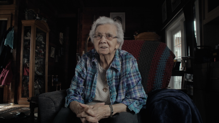
Helen Clifton, "Granny," a Gitga'at Matriarch
By 38, I had been adopted by the Raven Clan and my path led me to spend a winter teaching an Essential Skills for Work course to the young adults in Hartley Bay alongside Helen Clifton, a Gitga'at matriarch, leader and mesmerizing storyteller. 'Granny', as she is affectionately known, shared much of her traditional knowledge with the class, including the use of this ancient trade route for thousands of years by her ancestors. She produced old maps of the territory and pointed out the land bridge between the Quaal and Ecstall Rivers; only a short shouting distance separated the two valleys where "grease" had been carried. Hearing Helen's ancient cultural history lessons, the grease trail and the land called louder. I had to find the storied trail.
A Trail Greased by Oolichan Oil

The Oolichan Harvesting Process
Grease trails were vital corridors of exchange for over thousands of years. These well-developed cross-country paths linked coastal and interior communities, supporting the trade of goods between nations. Their main use on the north coast was for carrying oolichan grease. Oolichans (Thaleichthys pacificus) are small, smelt-like fish with buttery flesh rich in oil, and are highly prized by coastal First Nations. Known as the saviour fish, their annual spawning migration and return to the rivers at the end of the North Pacific winter when food supplies were low meant the difference between life and death. Today, a jar of Oolichan grease holds more value than silver and gold and is given out as gifts by Chiefs at potlatches.
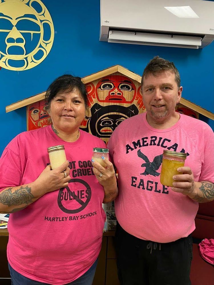
My adopted family Eva & Cam Hill with Grease from the Nass and Kemano Rivers pc: Rachel Hill
In Search of the Ecstall/Quaal River Grease Trail

Our Grease Trail Journey, Map: Norm Hann
Twenty years after I had first viewed the MacAllisters' images of the Quaal River, world adventurer, speaker, and author Bruce Kirkby and I planned a paddling trip to search for this old trail. With the help of "La'goot" Spencer Greening, a member of my fellow Raven Clan, we mapped the route and planned our trip for May, a time when the trail would have been in full use by the Gitga'at, Haisla and Kemano people for moving their highly prized grease. Our goal was to use our inflatable paddleboards and a week's worth of food, to retrace this route last used by the Tsimshian people well over a hundred years ago, with continuous use dating back thousands of years.
Departing from Old Town, Home of the Ancestors
Bruce Kirkby entering the Quaal River pc: Norm Hann
Once we received Granny's blessing, we travelled by boat north up Douglas Channel, landing on the shores of Kitkiata Inlet and Laxgaltsa'ap, "Old Town," the ancestral home of the Gitga'at people. With at least three village sites in the valley, thousands of years of continuous use, and a mountain top retreat site used during the great flood, the area provided the Gitga'at with everything they needed to thrive and survive. In 1889, they relocated to Hartley Bay for better access to their territory and more favourable weather.
Petroglyph on the shores of Kitkiata Inlet. Pc: Bruce Kirkby
Family member Jesse Bolton dropped us off on the shores of Kitkiata Inlet and Old town and we loaded up our inflatables amongst one of the largest petroglyph sites in the Pacific Northwest. Running our hands over these unique rocks, we asked for permission and safe travel across the land that belonged to the Killer Whale clan. Less than an hour after leaving Old Town, we entered the mouth of the Quaal River and soon passed Man Made Island, K'alahahaitk which means to "go against the tide," something Bruce and I would be engaged in for the next two days. An archeology study of the island in 1938 revealed ten longhouses, a village site the Gitga'at used for fishing and in times of war.
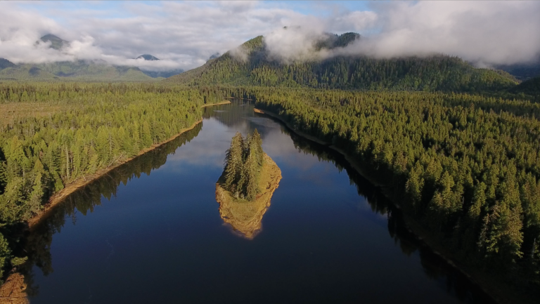
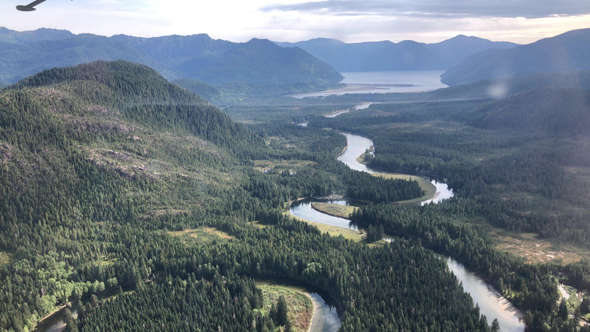
The Magnificent Quaal River and Man Made Island. PC: Mark Wunsch, Greencoast Media
The river narrowed as we paddled against it's flow past lush, green shorelines and prime Grizzly Bear habitat. Three hours later we landed at the "divide", our campsite for the night and another culturally significant landmark where generations of Gitga'at families have camped and harvested coho and pink salmon.
First night campsite at the "divide" on the Quaal River. Pc: Bruce Kirkby
A Sign of Ancient Sea Levels and Migration Routes
A bluebird morning greeted us as the warm rays of the sun filtered through the tops of the rainforest as we enjoyed hot coffee and a nutritious bowl of oatmeal. We were not far from the bend in the river "La'goot" Spencer had told us to look out for. Something caught my eye a few feet under our boards, white clam shells on the river's bottom. If these were the same types of shells found in the ocean, what were they doing this far up a freshwater river fourteen kilometres from the Pacific Ocean?
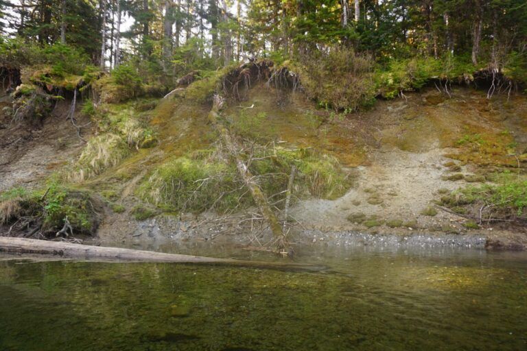
White clam shells visible on the lower level of the bank, indicating higher seas levels on the Quaal River. PC: Norm Hann
Spencer and his colleagues had studied here the previous year and concluded that the sea level was much higher after the glaciers had melted, creating ocean inlets of the Ecstall and Quaal rivers, a detail not found in the Gitga'at people's traditional coastal migration story. Had we been paddling the route approximately 12,000 years ago, "La'goot" theorizes we'd be floating on the ocean.
Stepping Back in Time, the Entrance to the Grease Trail
Pulling our boards in the Upper Quaal. Pc: Bruce Kirkby
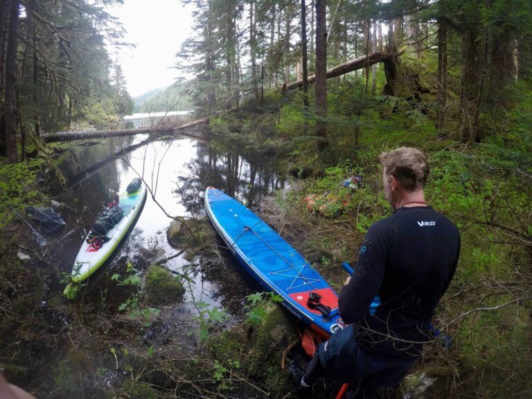
With thoughts of ancient migration routes and higher sea levels still on my mind, we pushed up the ever-narrowing valley. Without deep enough water to paddle, we began pulling our boards into the upper reaches of the Quaal. Signs of moose, grizzly bear and wolf were everywhere. The old-growth forest in the upper reaches of the Quaal was some of the most spectacular I have ever paddled and walked through. Red cedars soared above us, the same trees the Gitga'at would have selected to make canoes that would have travelled this same route. Navigating became a challenge as tree-fall and log jams blocked our path. In many sections, we reverted to shouldering our drybags and carrying the inflatables through the maze of snags and windfall as we began to sense the presence of the old trail.
Amongst giants and close to the entrance of the grease trail. pc: Bruce Kirkby
Using the route finding information Spencer shared with us, combined with the relative ease of scrambling up a river devoid of springtime growth that would not sprout for another couple of weeks, we could feel the trail was close. At another divide where the Quaal continued north to its glacial headwaters, we began to follow a small tributary using it as a handrail our topo map showed towards a natural gap between two hills.
"We have to be getting close!" called Bruce.
And then, there it was—the entrance to the grease trail. It was unlike any trail I have seen before and I remembered Spencer's words. "You'll know when you arrive, it will look like many feet have walked there."
We looked at each other in disbelief. I had tried to envision the trail in my mind but nothing prepared me for the sight of the two massive Red Cedar trees standing as a natural gate to the ancient trade route. The trees looked worn from many hands and the path was clear, like a hiking trail maintained by park staff—yet according to Helen Clifton, no one had passed here for well over a hundred years. It was a surreal and numinous feeling and presence overtook us. We were so overcome that neither of us remembered to photograph the trail!
We hugged and acknowledged a moment of gratitude to the spirit of the land, and to the ancestors who had travelled it before us. As we left the Quaal river and scrambled along the trail I couldn't help but wonder: How many people had travelled this route? Who were they? What were their names? What did they carry with them? I felt like we were walking with them and in a way I guess we were.
Entering Upper Ecstall Lake from the terminus of the grease trail portage. Pc: Norm Hann
We dropped our boards into Upper Ecstall Lake as a loon, fishing for trout, greeted us with it's haunting call. A short but very challenging log-filled section between the upper and lower Ecstall Lakes brought us into the Ecstall River and our campsite after an emotional 13-hour day.
Reflection at our Ecstall River Campsite after successfully finding the grease trail. Pc: Bruce Kirkby
Downriver Past Cathedrals and Ghost Towns
Entering a new river valley, the upper Ecstall. PC: Bruce Kirkby
After the previous day's challenge and emotion of finding the grease trail, Bruce and I floated down the emerald green waters of the upper Ecstall in a deep state of calm, surrounded by towering Sitka Spruce and pristine temperate old-growth forest. Two days spent paddling the lower Ecstall brought us past the majestic Madeline River Valley and its jaw-dropping views of skyscraping granite walls and feelings of stumbling upon one of the great wonders of the world. We concluded another big day at the ghost town of Port Essington, a historic salmon cannery community at the confluence of the Skeena River.
Entering the "Yosemite of the North", the majestic Madeline River Valley. Pc: Bruce Kirkby
On our final day we paddled across the Skeena River, and pushed on to our final destination of Metlakatla. With a massive sixty kilometer day, Bruce and I completed our journey, effectively wringing out any remaining stores of energy we had. The wildness and mystery of the old grease trail had released us. Although quiet, we shared a deep feeling of pride and connection knowing we had been a part of a greater and older story. I finished what I had started twenty years ago by following in the footsteps of the ancestors and doing my best to honor them in the process.
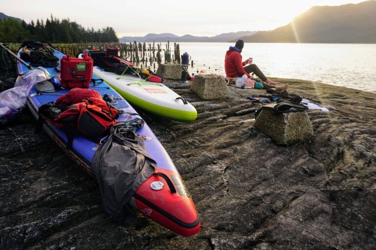
Our final night at Port Essington on the banks of the Skeena River. Pc: Norm Hann
Learn More About the Great Bear Rainforest
I wish I could bring every Gitga'at to retrace the route of this ancient trail. I give many thanks and acknowledgement to the Gitga'at and Tshimsian people and their land. I am so fortunate to retrace this route and steep myself in the cultural history of our wild coastlines.
Here are some books and podcasts I've enjoyed on the area:
- The Great Bear Rainforest Book: Ian and Karen McAllister.
- Stories from the Magic Canoe of Waxaid: Briony Penn and Cecil Paul
- Indigenous Harvesting Rights and Practices: Spencer Greening. I really enjoyed the podcast and it is eye opening.
If you were moved by this piece, please consider a purchase from our Stand Shop with proceeds going to the Standup4Greatbear Society to help support our wild coastlines.
Recent Posts