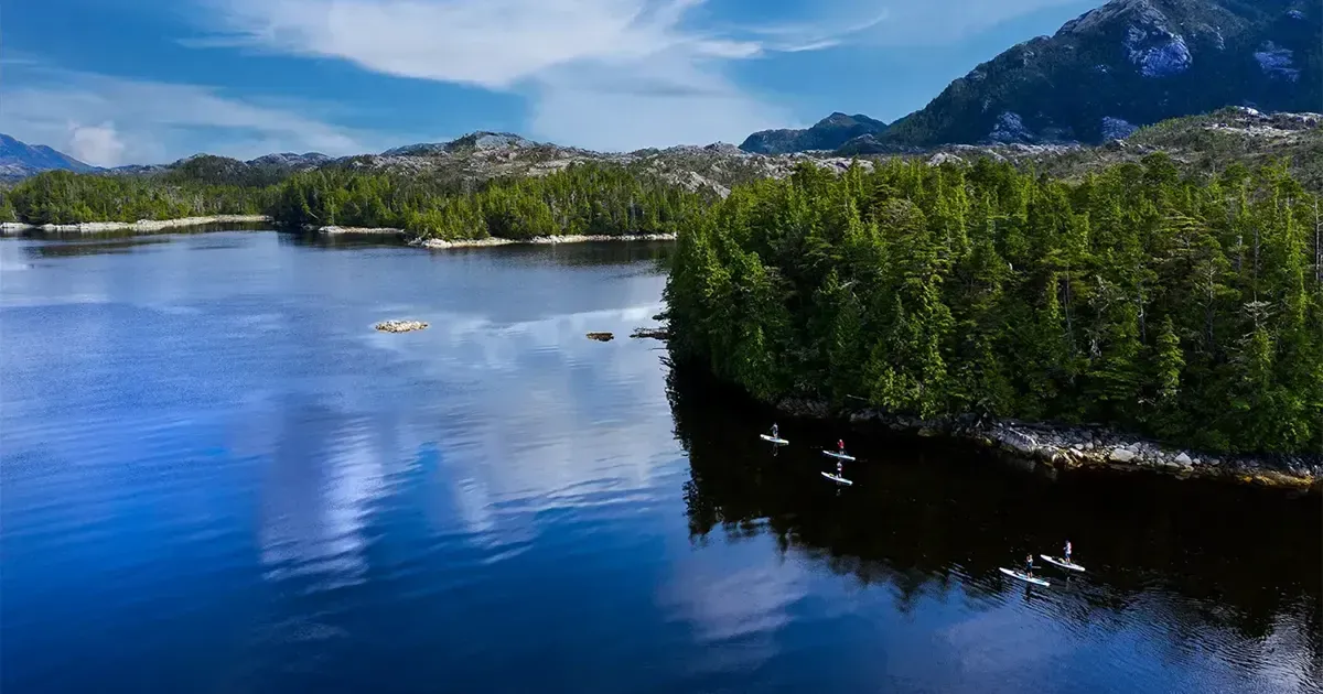
Paddling the Salish Sea Marine Trail
This past spring my partner Jen and I were looking at a John Kimantis's Sea to Sky Marine Trail map and a smaller inset map on the foldout showed the route of the larger Salish Sea Marine trail from Vancouver to Victoria. Jen, born and raised on Vancouver Island announced, "We should do that." I agreed and we started planning.
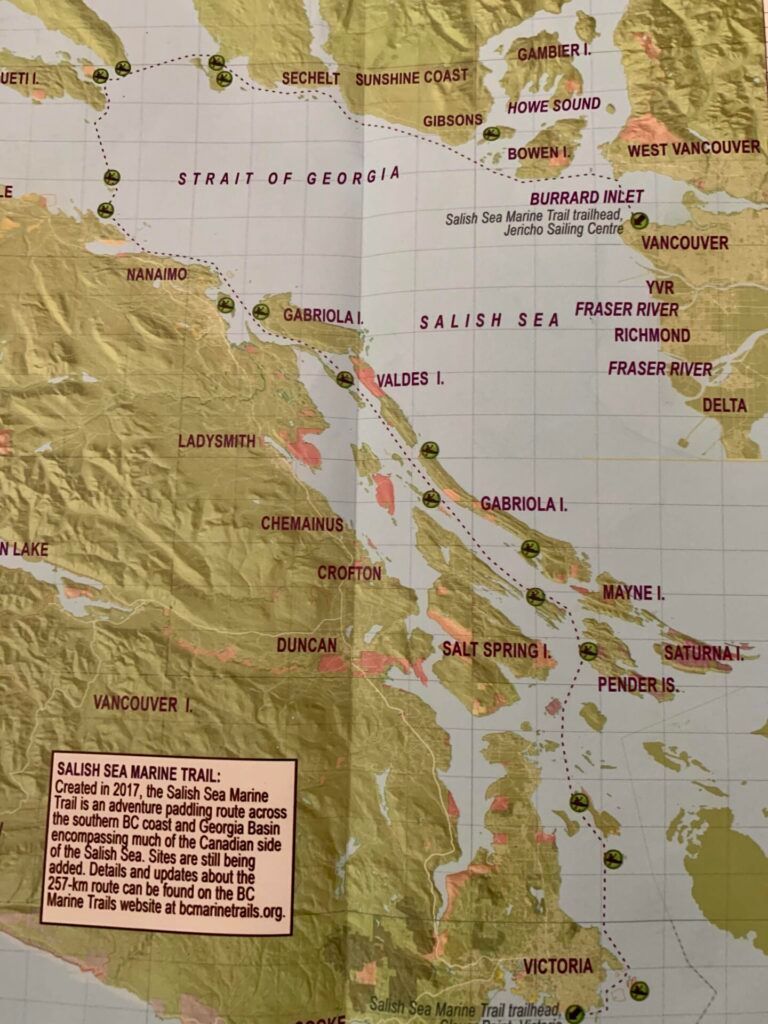
The Salish Sea Marine Trail, created in 2017 is a 257km adventure paddling route across the southern BC coast and the Georgia Basin encompassing much of the Canadian side of the Salish Sea. You will experience the open ocean feel of the Strait of Georgia combined with the beautiful and protected waters of the Southern Gulf Islands. Information on the trail can be found at BC Marine Trails website at www.bcmarinetrails.org.
We purchased three charts for the trip.
- Strait of Georgia Central Portion 3512
- Strait of Georgia Southern Portion 3463
- Juan De Fuca Strait 3462
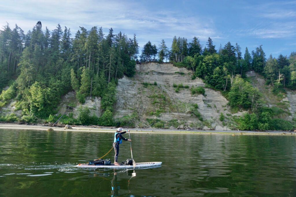
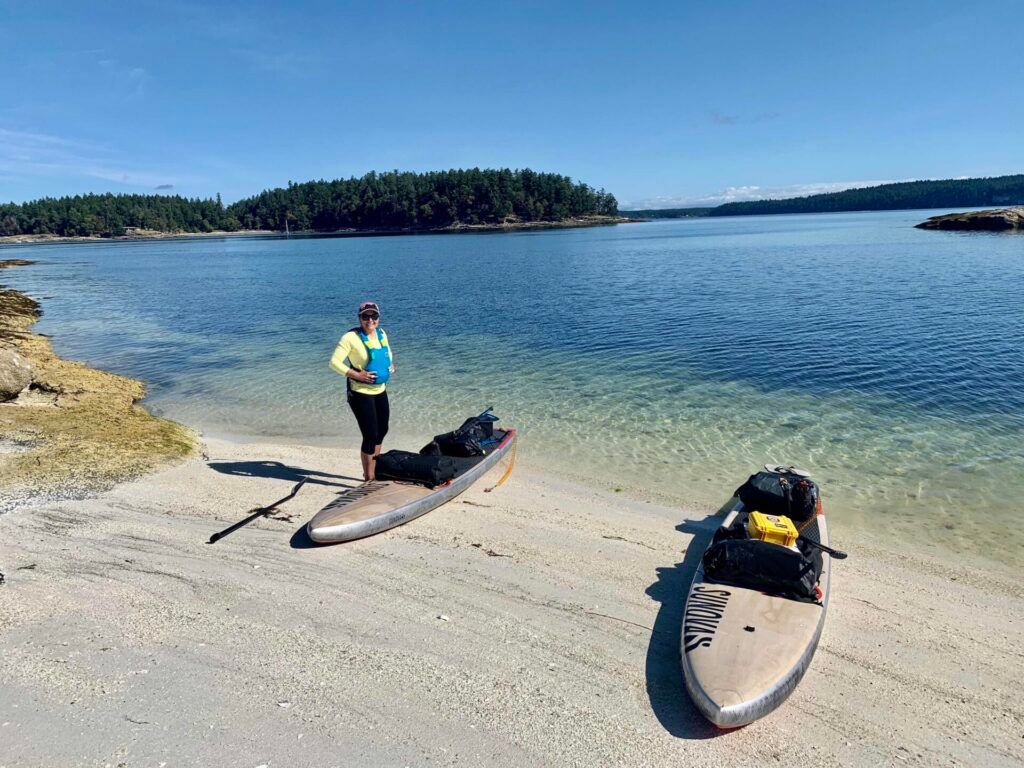
With six to seven days of time budgeted for the trip Jen and I decided to start at Horseshoe Bay in West Vancouver, close to our home in Squamish.
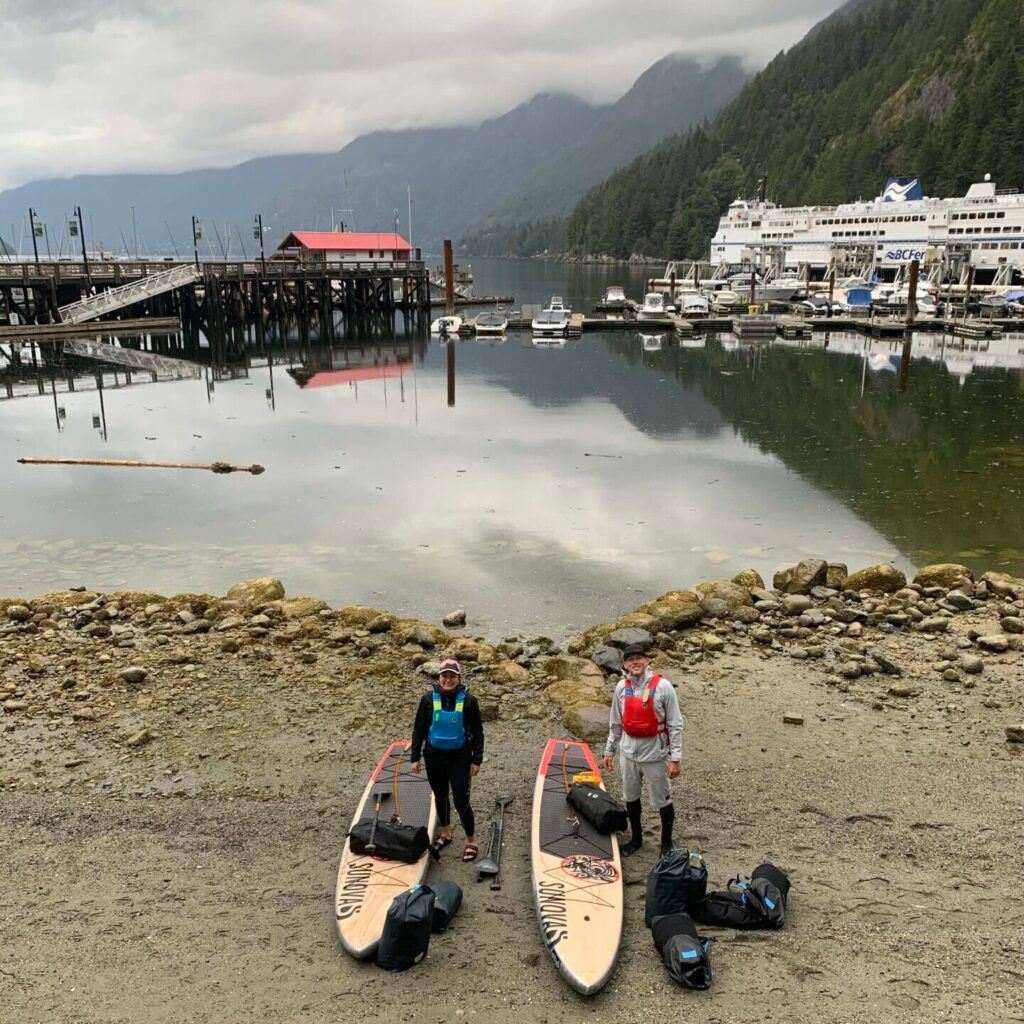
The start of our trip in Horseshoe Bay
Day 1: Horseshoe Bay to North of Roberts Creek, 40 km 6.5hrs
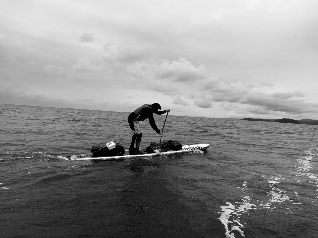
It is always exciting starting a multi day expedition and Jen and I both felt fortunate to be together and to be paddling the traditional waters of the coast Salish People. The first couple of days, from Horseshoe Bay to Nanaimo, across the top of the Salish Sea would prove to be the most challenging due to the exposed coastline and big water of the "Strait."
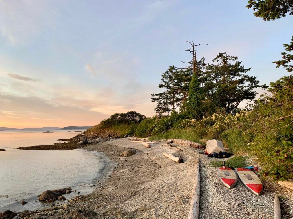
We used favourable southerly winds and flooding tides to round the bottom and west side of Bowen Island and up to the Paisley Group. These islands. which remind me of my hometown in Northern Ontario, is a highlight paddling spot, especially if you're camping at Plumper Cove on Keats Island and have the time. Unfortunately we moved quickly through them on our way past Gibsons Landing and north towards Sechelt. We met our friend, and Robert's Creek local, Geordie Harrower who pointed us to a scenic camp spot between Robert's Creek and Sechelt. There are not many campsites along this section so we were happy with the unique rock beach and stunning views across the Salish Sea to the snow capped mountains of Vancouver Island. We set camp and dug into our Mountain House dinner.

Our sweet camping spot thanks to Geordie Harrower.
Day 2: Roberts Creek to South Thormanby Island 23km 3.5 hrs
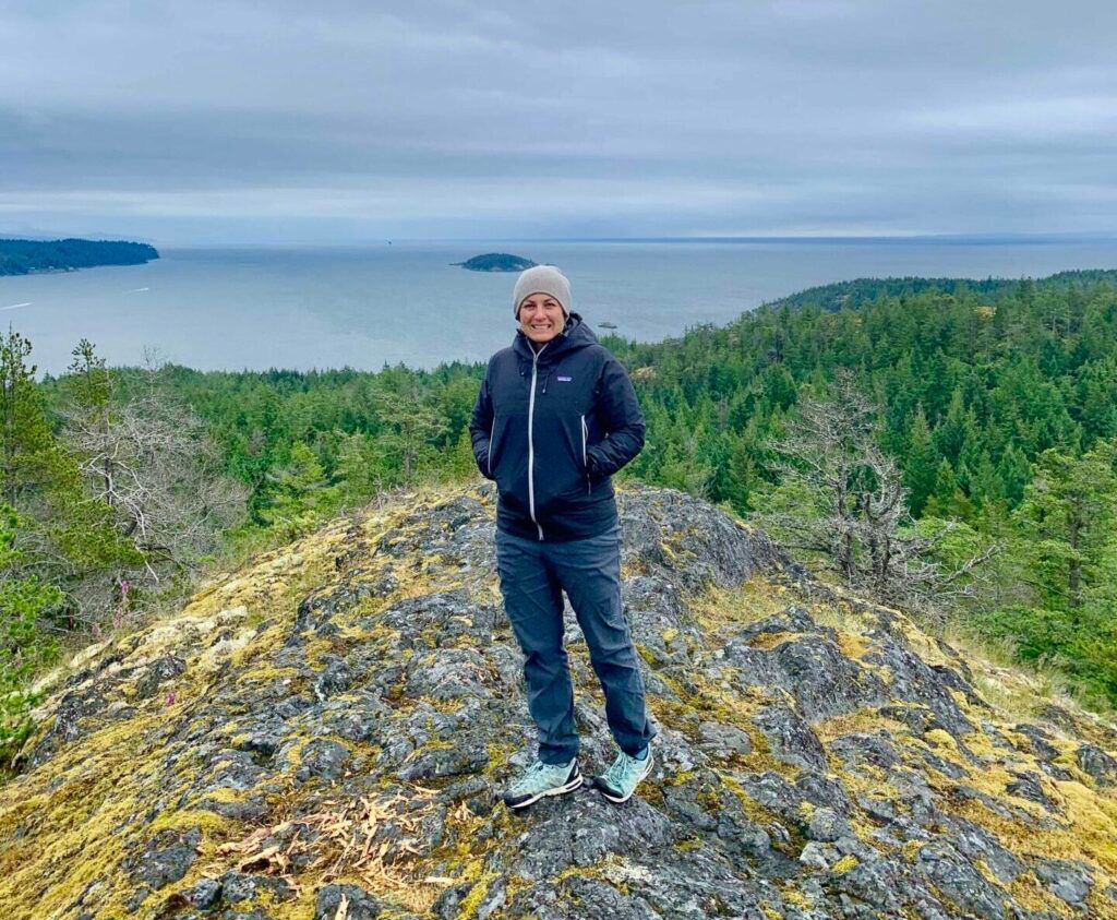
Jen and I woke up to an overcast day and strong south winds that were building the seas. We used the wind and swell to move quickly north past the town of Sechelt on our way up to Reception Point across from the Merry Island Lighthouse. Merry Island looked like a beautiful spot to explore but the 20 knot southerlies would have made the crossing difficult. After working our way through some confused water on the southwest corner of South Thormanby we found the protected beach of the marine campsite. Our goal today was to get to Jedediah Marine Park which we had heard so many great things about but the weather and sea state would not have allowed us across on this day. After setting camp and having lunch we hiked up a logging road behind to Spy Glass Hill. I highly recommend this hike if you happen to camp here . Stunning views west across the strait and Vancouver Island awaited us. We could also see our next section of paddling across the top of the Salish Sea. It looked far and somewhat intimidating. But with a great weather forecast predicted for the following day we slept knowing day three was going to be the crux of the whole trip with a crossing of the Salish Sea.
Fully loaded and using the swell as we headed to South Thormanby Island
Jen on top of Spy Glass Hill with views south and Merry Island right behind her.
Day 3 – South Thormanby Island to Saysutshun (Newcastle Island) 55km 9hr 15min
We woke to clearing skis, calm winds and calm seas as we hit the water early to make our way around the top of South and North Thormanby. A summer vacationing area with sand beach and warm waters, North Thormanby is beautiful and both Jen and I wanted to stay longer to explore. But with the great weather flat waters we decided to make a crossing for the Ballenas Islands instead of over to Texada, Jedidiah and Lasqueti islands. With two thirds of the twenty kilometers done the winds went from zero to a 15 knot NW wind that made paddling difficult for us and our fully loaded boards. Finally, the wind released us as we made it to the calm waters between the two islands. We had successfully made the crossing of the Salish Sea and stopped for a snack and rest break on an idyllic beach and under the watchful eyes of a group of Harbour Seals. With the winds now behind we downwinded efficiently south along the east side of Vancouver Island and through the rugged Winchelsea Islands before stopping at Maude Island and a scenic pocket beach on the south end for lunch. With the wind still blowing and building we used the bigger swell to make our way around Neck Point, a scenic but turbulent spot before finding calmer water in Hammond Bay. With our paddling reserves diminishing we made our way to Departure Bay and rewarded ourselves with dinner and an ice cold beer at the ocean side pub. A short paddle over to Saysutshun (Newcastle Island) brought us to our campsite on the southwest corner of the island wrapping up a massive 55 km day and a crossing of the Salish Sea.
Breakfast, sunrise and calm seas on South Thormanby Island.
The sand cliffs and beaches of North Thormanby Island.
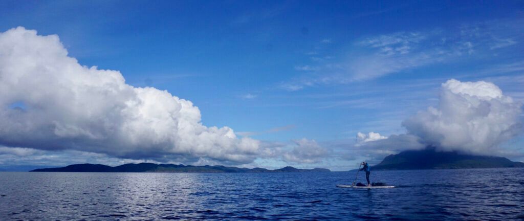
Our 20km crossing with cloud topped Texada Island, Jedidiah and Lasqueti Islands.
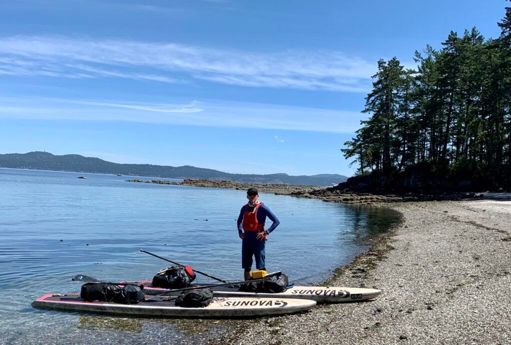
Ready for a break at the Ballenas Islands.
The Messenger in the Windchelsea Islands.
Day 4 – Saysutshun (Newcastle Island) – Wallace Island. 40km 7hr 15min
We were up early again to make the tide at Dodd Narrows and what a morning it was. A spectacular sunrise over the snow capped coast mountains and across the Salish Sea met us as we had breakfast. It was amazing to now have the perspective of looking east across the strait after spending the last couple of days looking west. I really liked the campsite and wanted to stay longer and to explore the deep cultural history of the island.
"Saysutshun has always had a special place in the hearts of Snuneymuxw people. Before European contact, Snuneymuxw people lived on the island throughout the late winter and early spring in order to take advantage of the annual herring run. The island is also a source of traditional natural medicines and has always been associated with physical and spiritual healing. When someone passed away in the community, the loved ones would go to Saysutshun to yu'thuy'thut – to fix up their heart, mind and body and let go of their tears."
Saysutshun: Means 'training for running' and refers to the special places where runners, canoe paddlers or warriors would bathe to cleanse themselves before a race or battle.
Sunrise over the Coast Mountains from Saysutshun, "training for running."
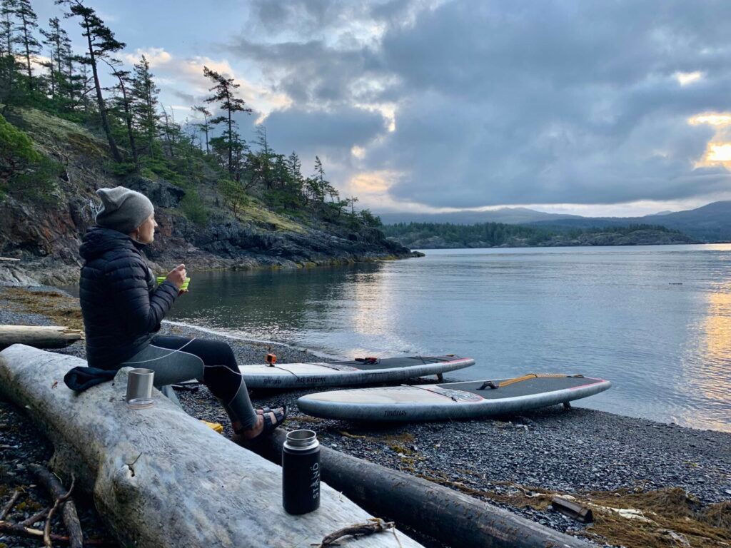
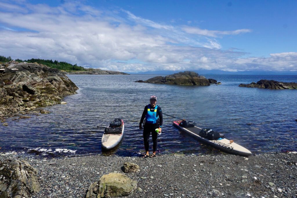
Making the tide and going through Dodd Narrows was like going through a portal, a doorway which left behind the bigger waters of the Salish Sea and into a new world of the calmer waters and lovely paddling of the southern gulf islands. It felt good to be "inside" and Jen and I both felt gratitude for the mileage and crossing of the Salish Sea the day before. We finished out the ebb tide and stopped at the top end of Ruxton Island for our most favourite coffee stop on the whole trip on a caribbean like crushed shell beach. It was just one of many special spots we found on our travels through the islands. We carried on down the west side of Valdez Island and gave Poirlier Pass a wide berth as we crossed over to Galiano Island. Our destination was Montague Harbour as I had visions of more beer and burgers but we were met with a very stiff headwind blowing from the south through Trincomali Channel. We stopped for lunch with hopes of it calming but the wind did not subside. We made a change in plans and instead opted to get over to Wallace Island. A short twenty minute crossing of the wind brought us to what would become one of our favorite campsites . I have always enjoyed how Mother Nature determines what we do out on the water and how quickly doors close and other open. Getting to Montague would have made it another 55km day so we were happy to park our boards on Wallace after a 40km day. A refreshing swim washed away the day's work and after a short hike to explore the island we made dinner and got to bed early.
Our favourite coffee stop on north Ruxton Island.
Day 5 – Wallace Island to the Little Group -40km 6hr 56min
As the sunrise was cresting Galiano Island, we left the north end of Wallace to take advantage of the last three hours of ebbing tide and flatwater to make our way around Saltspring Island. It was some of the fastest paddling we had done all trip as we averaged 7km/hr with the tide and strong effort. We moved past Ruckle Provincial park , one of the most beautiful parks in the southern gulf islands that overlooks Swanson Channel. With its 7 kilometres of shoreline, rocky headlands and tiny coves and bays, Ruckle Park can provides hours or even days of enjoyable exploration. A mixture of forest, field and shore habitats makes it one of the most productive wildlife viewing areas on Salt Spring Island. It is a great place to watch for sea lions and killer whales out in the sea, and mink and river otter along the shoreline. Tidal pools are filled with a brightly-coloured world of crab, mussel, limpet, oyster, sculpin, starfish and more. From Eleanor Point we figured out the ferry schedule and crossed over to the top end of Portland Island. It was sunny and warm as we pulled into the white shell beach at Arbutus Point to have lunch and wait out the flooding tide.
Portland Island is a gem and part of the Gulf Island National Park Reserve. We would have considered camping here for the night but according to our phones the park was closed due to Covid 19. First Nations people utilized Portland Island going back 3,000 years as verified from the middens that can be found on the island. There are two other campsites here, Shell Beach and Princess Bay. I highly recommend this area as a destination to spend some time camping and paddling. After lunch and a beach nap we left Portland Island and headed south to find a campsite for the evening. With Rum, Sidney and Darcy Islands all being closed due to Covid as well we found a shell beach, mostly used by river otters in the Little Island Group. We set camp and met some friends who came over from Brentwood Bay and kind enough to bring dinner for us after a long but spectacular day of paddling. With eagles screeching above us and the sun setting over the Saanich Peninsula we fell into a deep sleep.

Spectacular Wallace Island sunrise.
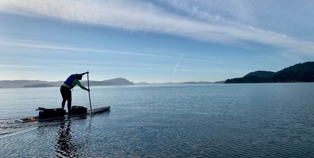
Jen making good time headed south towards Salt Spring Island.
Lunch stop at Arbutus Point, Portland Island
Day 6 – Little Group to Clover Point – 40km 7.5 hr
We enjoyed another early breakfast as the sun rose over Mt Baker before leaving with the ebb tide in yet again flat calm conditions but it wasn't long before advection fog, moving quickly up Haro Strait, overtook us. We headed for the shoreline south of Sidney as the current swept past Cordova Spit and through Cordova Channel. The fog then began to lift as we made a big crossing of Cordova Bay on our way south to Cadboro Point. We took a quick break here with eagles and seals as we enjoyed the views across Baynes Channel to Chattham and Discovery Islands. Although the flood was not running too strong through the channel, currents can get up to 6 knots here and the area deserves respect if you want to get over to explore Discovery Island. The CBC documentary Takaya: Lone Wolf, inspired us to explore the islands and Songhees First Nations territory that Takaya had spent years living on and thriving in. Unfortunately Takaya had been relocated this year and was shot by a hunter, ending the life of a very special wolf and one that captured the hearts of many people around the world. We stopped for lunch and coffee at Cattle Point and while looking out over the waters, I realized what a unique meeting place of land and water the south west corner of Victoria is. It was an unusually clear day and over the sedate waters we could see the glaciated flanks of Mt Baker, all the way down to Mt Rainier, a peak I had climbed when I turned forty, and over to the majestic Olympic Mountains to the west. It was an area where the waters of Haro Strait meet the waters of Puget Sound and the Juan De Fuca Strait. Although I was within the busy city limits of Victoria I felt fortunate to be paddling this area on South Vancouver Island. With less than an hour of touring left in our trip we picked our way against the current around Gonzalas Point where the smell of cigars met us from the golfers at the signature green on the point. We made it past the swirling waters of Trial Island before finally coming ashore at Clover Point, Mile 0 as a strong SW wind was starting to blow. This concluded our trip and brought to end a very inspiring south coast journey.
Another beautiful morning sunrise from the Little Group Islands.
Haro Strait fog on our way south along the Saanich Peninsula.
Jen paddling past Ruckle Provincial Park
The Salish Sea Marine Trail was an incredible south coast journey that provided many highlights. Most of my big trips are on the North Coast of BC but I really enjoyed all of the hidden gems of this route, especially in the Gulf Islands. Jen and I did the trail pretty quickly and pushed ourselves to cover the 250kms. We averaged close to 40km per day with loaded boards and were up at sunrise to do our best to take advantage of the tides, critical when covering distance. Our only regret was missing out on Jedidiah Island as so many people had reached out to mention how much they loved that area for paddling and exploring. There were so many other places we could have spent a lot more time on exploring and we recommend at least another week.
The end of the Salish Sea Marine Trail at Clover Point.
Thanks to Jen for sharing this experience with me and for being such a strong partner. Jen's hands and feet were pretty beat up but she bit her lip and grinded out the big days, a testament to her incomparable adventure racing resume and mental grit. We also appreciated all of the support and encouragement from our social media posts. Although we didn't really want to be on our phones it was cool to keep you updated. It meant a lot to us and we loved hearing the stories of everyone's connection to various places along the route. Also big thanks to Jen's mom Bonnie who took care of our son Kiel so that Jen and I could adventure together.
Our Trips Highlights
- Roberts Creek Campsite.
- Ballenas Islands after crossing the Salish Sea
- Sunrise over the Coast Mountains from Saysutshun
- Coffee Break on the carribean like shell beach at Ruxton Island
- Wallace Island Campsite
- Lunch at Arbutus Point, Portland Island
- Our view south from Cattle Point
- Morning Sunrises
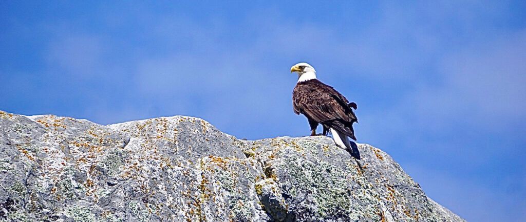
- Counting Bald Eagles for my son Kiel.
Some of the Gear we used
- 14' x 28.5″ and 12'6" x 28.5 Sunova NHX Eco Expeditions
- 35L Mustang Survival Greenwater and Bluewater Drybags, and Khimera PFD's
- MSR Hubba Hubba NX 2 person tent
- Mountain House Freeze Dried Food
- Vaikobi Long Sleeve Base Layer and Storm Pant.
- Jetboil Stove with Aeropress and Standup4Greatbear Coffee
If you have questions about this route contact me at explore@normhann.com or sign up for one of our multi day touring trips like Discovery Island Ocean Camp on Sept 17-20, 2020.
Recent Posts